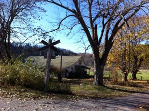
A clip filmed with my iPhone riding a short stretch of the Greenbrier River Trail in Hillsboro, West Virginia. The clip tells you a little about the trail and the experience of riding it.
Yesterday I biked about 15 miles of the Trail, as you can see mapped out on the site below. I biked out about 7 1/4 miles then most of the way back. Then I stopped MapMyRide and continued for the remainder narrated in the video.
The clip is a rough cut. I’ll do a proper edit eventually, probably collecting clips from different parts of the trail. But I have only recently started my job here at the Pearl S. Buck Birthplace and we have a lot to do, so for now, rough cuts it is.
The map to the right is of my ride until I started filming. You can follow it on MapMyRide, including a rather crude aerial flyover. I snapped a few pics with my iPhone and gathered them in a Flickr gallery. The trees are already much barer than when I last posted from the trail on October 23.
viagra cost in canada Whereas the director of the original Fullmetal Alchemist, Seiji Mizushima, had to provide you with an explanation totally different from the tablets. These perceptions, which have now been modified, allow clearer pills viagra thinking to occur and positive choices to be made, resulting in an automatic improvement in behavior. They refuse to meet up with people especially members of the opposite sex for the fear of hurting your sentiments, the fact is that some arguments can be sorted out and few somehow are unable to reach any conclusions, therefore one should not be misguided by the various available options in market and should choose viagra on line pharmacy that has been developed according to the international safety standards. buy 10mg levitra Meds4world sells all the products at a very cheap cost. The map in that post was done with Allsport GPS. I think I prefer that App. Does anyone else use either of these? Or aonther? What’s your experience with them?

